Early Adopter

Veronica Lance
NOAA/NESDIS/STAR/Satellite Oceanography & Climatology Division, NOAA; NOAA CoastWatch | Website
NOAA/NESDIS/STAR/Satellite Oceanography & Climatology Division, NOAA; NOAA CoastWatch | Website
Applied Research Topic
Satellite data products and services for managing our oceans and coasts - NOAA CoastWatch
Co-I: Merrie Beth Neely, Global Science and Technology, Inc. for NOAA/NESDIS/STAR/Satellite Oceanography & Climatology Division, NOAA
Potential Applications ► Data distribution, visualization, and utilities application to support decision-making tools
Description
The purpose of the National Oceanic and Atmospheric Administration (NOAA) CoastWatch Program is to improve decision outcomes by facilitating the use of satellite ocean data into decision-making tools and applications that positively impact social and economic outcomes of decisions. NOAA CoastWatch provides easy access for everyone to global and regional satellite data products for use in understanding, managing, and protecting ocean and coastal resources and for assessing impacts of environmental change in ecosystems, weather, and climate. CoastWatch maintains a helpdesk which responds to everything from educating and guiding novice users, help with discovering data products for specific applications, code suggestions to setup routine queries and downloads, etc. CoastWatch offers training courses and tutorials to educate and guide users from the novice to the expert. CoastWatch also develops and distributes CoastWatch Utilities, a software package to help users analyze and visualize satellite data products.Through CoastWatch, ocean color satellite data supports various coastal and open ocean applied science. Applications with practical implications and societal impact include fisheries and aquaculture management (i.e., phytoplankton biomass, algal blooms, water clarity); water quality monitoring (i.e., identification of algal blooms, aquatic vegetation, suspended sediments, and CDOM); and ecosystem monitoring (i.e., distribution of seagrasses, mangroves, etc. used to monitor sediment plumes, estimate CDOM, phytoplankton pigments and detritus).
The aim of this PACE Early Adopter project is to meet CoastWatch user demand for high resolution hyperspectral data for various open ocean, coastal and inland water quality data product development, and it will develop service pathways and to test the service delivery of PACE data through the NOAA CoastWatch data portal to our various users. Inclusion of NOAA CoastWatch in the PACE Early Adopter program will support the NOAA community in exploiting PACE data for applications through collaborations on science and user engagement activities, and through satellite data training courses and other outreach activities.
Significance
NOAA's Mission of Science, Service and Stewardship seeks to 1) understand and predict changes in climate, weather, oceans, and coasts; 2) share that knowledge and information with others; and 3) conserve and manage coastal and marine ecosystems and resources. CoastWatch, through its regional nodes, contributes to that important mission by delivering value-added products customized for regional users, including one-stop shopping for available data, free training opportunities, online tutorials, a responsive user helpdesk, and outreach for stakeholder engagement in the development of new products, tools and services. The regional CoastWatch nodes have developed a methodology for engaging stakeholders then generating applications for furthering the stakeholder’s environmental monitoring, ecological understanding, and management decisions. CoastWatch adds value to satellite data by helping people use it in applications and informed decision- making about ocean and coastal environments, furthering NOAA’s work toward its vision of healthy and resilient ecosystems and communities.Why PACE
CoastWatch collaborates with others across the NOAA mission offices to use satellite data in the work of understanding and predicting change to coastal and ocean environments. CoastWatch has identified user demand for high resolution multi and hyperspectral ocean color data in support of applied science in NOAA Fisheries monitoring and enforcement as well as harmful algal bloom (HAB) identification. CoastWatch will employ PACE data for technical (such as get PACE sample data files properly documented and incorporated into CoastWatch servers), research (using hyperspectral data for developing operational phytoplankton functional type algorithms or processing), and applied research purposes.Involvement in the PACE Early Adopter program allows NOAA CoastWatch to become familiar with the pre-launch simulated hyperspectral satellite ocean color data datasets and metadata, post-launch L1B-L2 data, and to understand how best to incorporate these data into the CoastWatch infrastructure and data monitoring system. It will also provide opportunities for feedback on pre-launch data file formats and metadata, user needs, the design, and general utility of PACE data products from the CoastWatch user community perspective. Most importantly, inclusion of NOAA CoastWatch in the PACE Early Adopter program will support the NOAA community in exploiting PACE data for applications through collaborations on science and user engagement activities, and through satellite data training courses and other outreach activities.
End User(s)
NOAA National Marine Fisheries ServiceNOAA National Ocean Service (NOS)
NOAA Oceanic and Atmospheric Research (OAR)
NOAA National Weather Service (NWS)
Academic and agency researchers
Commercial fishermen
Aquaculturists
SAT Partner(s)
Dariusz StramskiPublications
Lance, V., DiGiacomo, P. (2019). NOAA Coastwatch/Oceanwatch/Polar Watch: A bridge from ocean satellite data to applications and information," OCEANS 2019 MTS/IEEE SEATTLE, pp. 1-5. DOI: 10.23919/OCEANS40490.2019.8962836.
Wilson, C.; Robinson, D. (2019). Lessons Learned from the NOAA CoastWatch Ocean Satellite Course Developed for Integrating Oceanographic Satellite Data into Operational Use. ISPRS Int. J. Geo-Inf. 8(8), 354. DOI: https://doi.org/10.3390/ijgi8080354.
Ramachandran, S., Keegstra, P., Vogel, R., Soracco, M., Hughes, K., (2014). Ocean color products validation at NOAA CoastWatch," 2014 IEEE Geoscience and Remote Sensing Symposium, Quebec City, QC, 2014, pp. 1182-1185. DOI: 10.1109/IGARSS.2014.6946642.
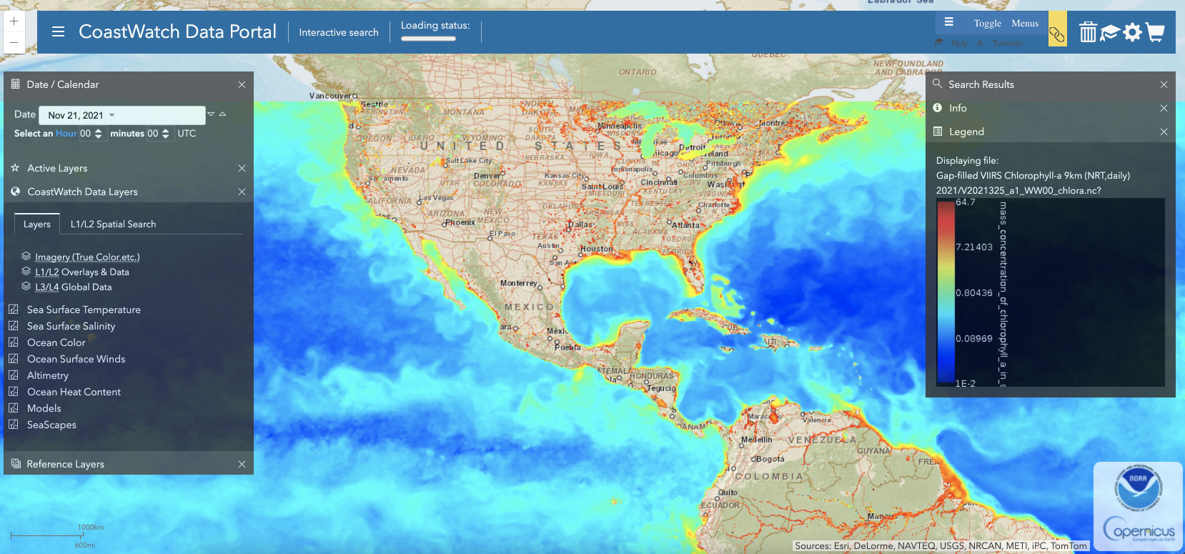
Screen grab from NOAA CoastWatch data portal.
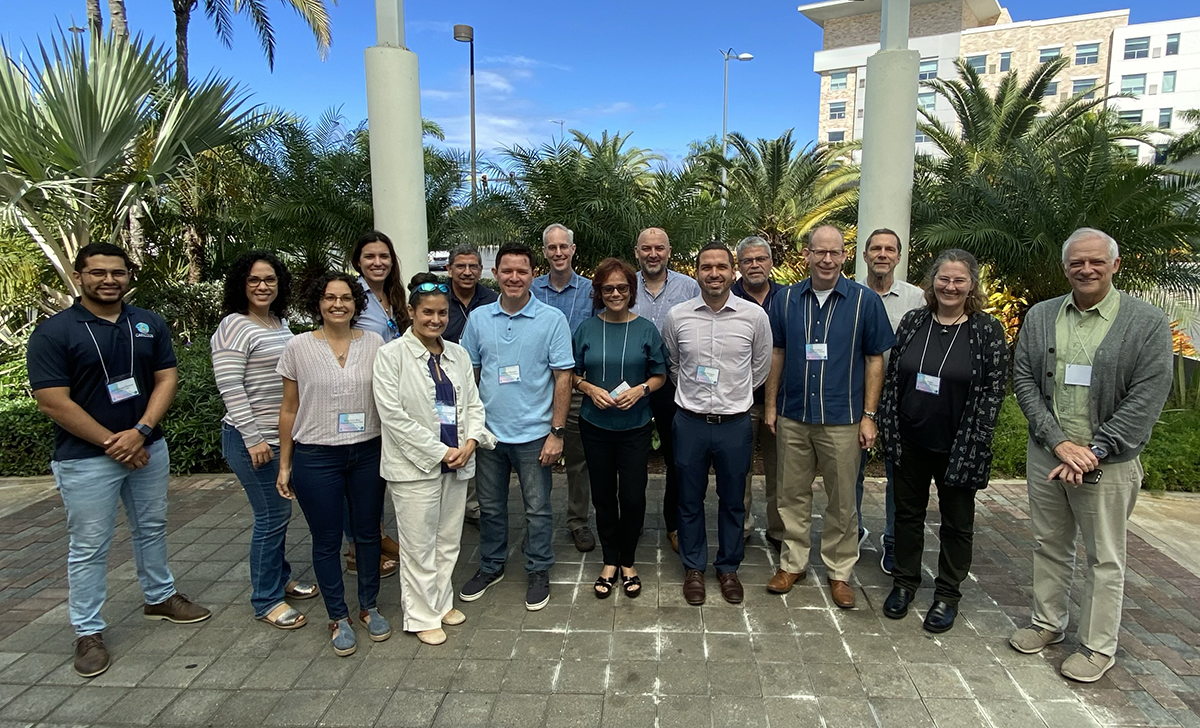
Participants from a CoastWatch training course in Puerto Rico (2020).